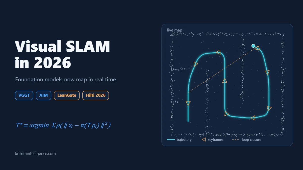
For most of the last decade, building a visual SLAM system meant the same routine. You picked a feature detector, tuned a tracker, calibrated your camera and hoped the scene had enough texture. That recipe still works, and systems like ORB-SLAM3 are still running on robots all over the world. But 2026 has made one thing plain: large pretrained 3D models are moving out of offline reconstruction and into live mapping.
This post covers the visual SLAM updates from this year that I think matter most, and what they mean for robots and drones that have to find their way without GPS.
What Changed in Visual SLAM
Models such as MASt3R and VGGT look at a handful of images and predict 3D points and camera poses directly, in a single pass through the network. They do not need a calibrated camera, and they handle plain walls and low texture far better than classic feature matching.
The catch has always been speed and drift. These networks are heavy, and stitching their outputs into one consistent map over a long run is hard. Three pieces of work from 2026 go straight at those two problems.
VGGT-SLAM 2.0: Real Time Dense Mapping With Less Drift
In January, Dominic Maggio and Luca Carlone at the MIT SPARK Lab released VGGT-SLAM 2.0. The paper was accepted at RSS 2026 in May.
The first version had a weak spot. When it joined chunks of VGGT output together, it solved for a 15 degree of freedom transform, which let drift build up and could fail in flat, planar scenes. Version 2.0 redesigns the factor graph to remove that drift and the planar failure, while still handling the scale and calibration uncertainty that comes with an uncalibrated camera.
The second idea is my favourite. The system uses a single attention layer inside VGGT to check whether two images really show the same place before it accepts a loop closure. It needs no extra training. That check throws out false matches, so the system can close more loops with confidence.
The results:
- About 23 percent lower pose error than the first version on the TUM benchmark.
- Live operation on an NVIDIA Jetson Thor mounted on a ground robot.
- Mapping of apartments, offices and a 4,200 square foot barn.
- A BSD license, so companies can build products on it.
AIM-SLAM: Choosing Better Views for the Model
A team at KAIST (Jinwoo Jeon, Dong-Uk Seo, Eungchang Mason Lee and Hyun Myung) asked a different question: which past frames should you hand to the model at all?
Most foundation model SLAM systems feed VGGT or MASt3R either a pair of images or a fixed window of recent keyframes. That often means near duplicate views and wasted effort. AIM-SLAM picks views by how much they overlap with the current keyframe and how much new geometric information each one adds. It then tests whether a few more views are worth including, caps the input at five views and optimizes all the poses together.
The numbers on EuRoC, the classic drone dataset, stand out:
- 7.2 cm average trajectory error on EuRoC, against 16.4 cm for MASt3R-SLAM.
- 3.1 cm on TUM without any calibration, close to calibrated MASt3R-SLAM.
- About 3 Hz overall, with VGGT inference as the bottleneck.
LeanGate: Skipping Work Before It Happens
Researchers from UW Madison, Texas A&M, USC and UNC Chapel Hill spotted a simple waste. Systems like MASt3R-SLAM run the full heavy model on every frame and only afterward decide that the frame added nothing new.
Their LeanGate network predicts, before the expensive step runs, whether a frame will be useful. It lets through roughly one frame in sixteen to one in thirty two. The effect:
- Tracking compute drops by more than 85 percent.
- The full pipeline runs 4 to 5 times faster.
- Accuracy holds or improves on TUM and 7 Scenes.
- Error rises on EuRoC, from 4.1 cm to 4.9 cm, a tradeoff the authors report openly.
The Hilti Trimble SLAM Challenge 2026: A Reality Check
Benchmarks keep everyone honest. The 2026 Hilti and Trimble challenge, run with the Dynamic Robot Systems Group at the University of Oxford, moved to active construction sites.
The data came from a consumer 360 camera with two fisheye lenses, a rolling shutter and a 1000 Hz IMU, across 30 runs on several floors. Teams were scored on two tasks: plain SLAM, and localizing against the building floor plan. That floor plan shows the design, not what was actually built.
Changing light, repeated textures and walls that do not match the drawing are exactly the conditions where lab results fall apart. Winners were announced at ICRA in Vienna in June, and the full dataset went public on Hugging Face in August.
What These SLAM Updates Mean for Drones
For anyone building aerial robots that fly without GPS, this direction is encouraging, and the gap is still real.
A drone moves fast, shakes and runs on a small battery. A map that updates three times a second is not enough to fly on by itself. The practical pattern for now looks like a hybrid:
- A fast visual inertial tracker keeps the vehicle stable at a high rate.
- A foundation model builds the dense map and checks loop closures in the background.
- A gate like LeanGate spends compute only on frames that matter, so the whole system fits on onboard hardware.
Each of the three projects above solves one piece of that puzzle. Put together, they point to drones that can map a building and find their way around it on their first flight through it, with no GPS and no special preparation.
If you are working on any of this, I would like to hear what you are seeing in your own tests.
Sources
- VGGT-SLAM 2.0 paper: https://arxiv.org/abs/2601.19887
- VGGT-SLAM code (MIT SPARK Lab): https://github.com/MIT-SPARK/VGGT-SLAM
- AIM-SLAM paper: https://arxiv.org/abs/2603.05097
- LeanGate paper: https://arxiv.org/abs/2604.08718
- Hilti Trimble SLAM Challenge 2026: https://github.com/Hilti-Research/hilti-trimble-slam-challenge-2026